
Case Studies.
SEEDLING COUNTER
A major Australian Eucalyptus grower used SKYLAB technology to assess the survival and weed density of 4000ha new planting. Precision maps with 320x20m grid cells help the plantation manager focus his actions on hotspots with weeds or low densities. All based on off-the-shelf DJI Mavic Pro 2 normal colour imagery.
“Greatest innovation I’ve seen in forestry for a long time, to say the least; unreal! I think this info is going to highlight some of the problems in field we have as establishment people, this will help no end and hopefully we will grow better stands going forward.”

Bark Beetle Detection R&D (Germany)
barkbeetle is a forest pest causing billions of Euro in damage every year and there is no other way to fight it than finding the trees in time and removing them. SKYLAB has invested some heavy R&D into finding infected trees quickly - with some success!
Here is a comparison of terrestrial search with a drone based survey - showing hotspots identified and even a number of individual trees matching in the closed stands. In addition we analysed satellite images (from World View 4) to check what is visible in those at the end of the season. In mid August all those early diseased trees showed up as significantly damaged in the satellite images.
This is a great tool for tidying up after the bark beetle has done its dreadful work. And also to identify the most likely hotspots of new infections in the following year.


June 2018 Timber Trade News in Australia stirring an interest in SKYLABs pioneering work on the early detection of bark beetle in spruce forests using multispectral imaging.
June 2018 McKinsey "Precision forestry: A revolution in the woods" underlines the potential of precision forestry to reduce costs and, more importantly, maximise yields and overall performance in commercial forestry and plantations. Exactly describing the technologies that SKYLAB is developing and applying in forest inventories and management today!

May 2018 New Scientist reports about SKYLAB work on stress and disease detection in trees, for example on bark beetle and potentially other plant diseases in orchards, vineyards etc.
(Unfortunately the article is only available to subscribers or as paid content.)


Pine Plantation Valuation (Argentina)
SKYLAB carried out a complete inventory and valuation assessment of a 7000ha pine plantation in Northern Argentina for a European Investment Fund, in collaboration with specialist forestry advisory TSS Forstplanung. The data acquisition was carried out by light weight plane Lidar and hi-res photography. SKYLAB applied its highly specialised tree detection and 3D mapping skills, combined with TSS terrestrial sampling and valuation expertise to provide a full inventory within less than six weeks.
Investment Fund Yield Projections (Scotland)
AQUILA CAPITAL is the first institutional investor in Scotland to apply the SKYLAB forest inventory method on a 2000ha plantation, delivering a full inventory, species composition, timber stock and new compartment boundaries for harvest planning. All within a matter of weeks and without the need for any terrestrial sampling.


Pine Plantation Survival Rates (Argentina)
An Argentinian pine plantation owner plants 2000ha of new pine seedlings every year. Survival rates one year after planting are normally done by spot checks taking several days of walking and counting. SKYLAB image recognition technology delivers survival rates over complete area with more than 95% accuracy within hours. This allows the plantation manager to replant areas of significant mortality and he can now pay the planting contractor based on the success rate of his planting efforts
Valuation for Forest Investment (International)
An institutional investor needed a fast and precise assessment of a mixed pine and spruce forest to decide on its bidding for the acquisition process. SKYLAB's methodology provided a full inventory and clearly showed the strengths and weaknesses of the forest asset in all its detail per sub-compartment.

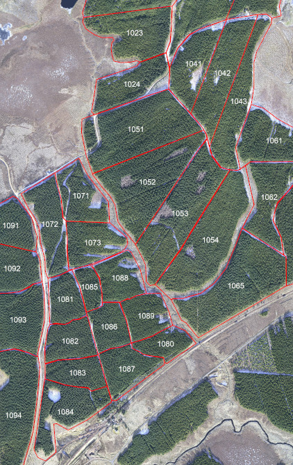


Pine Forest Inventory (Germany)
Drone based data to carry out 10-year inventory on private, multi-aged pine forest (500ha) in Brandenburg. SKYLAB method delivered hi-res orthomosaic, tree height model, tree count and height per compartment to significantly reduce terrestrial sampling. The comprehensive, high precision data provide basis for reshaping into more efficient management areas.
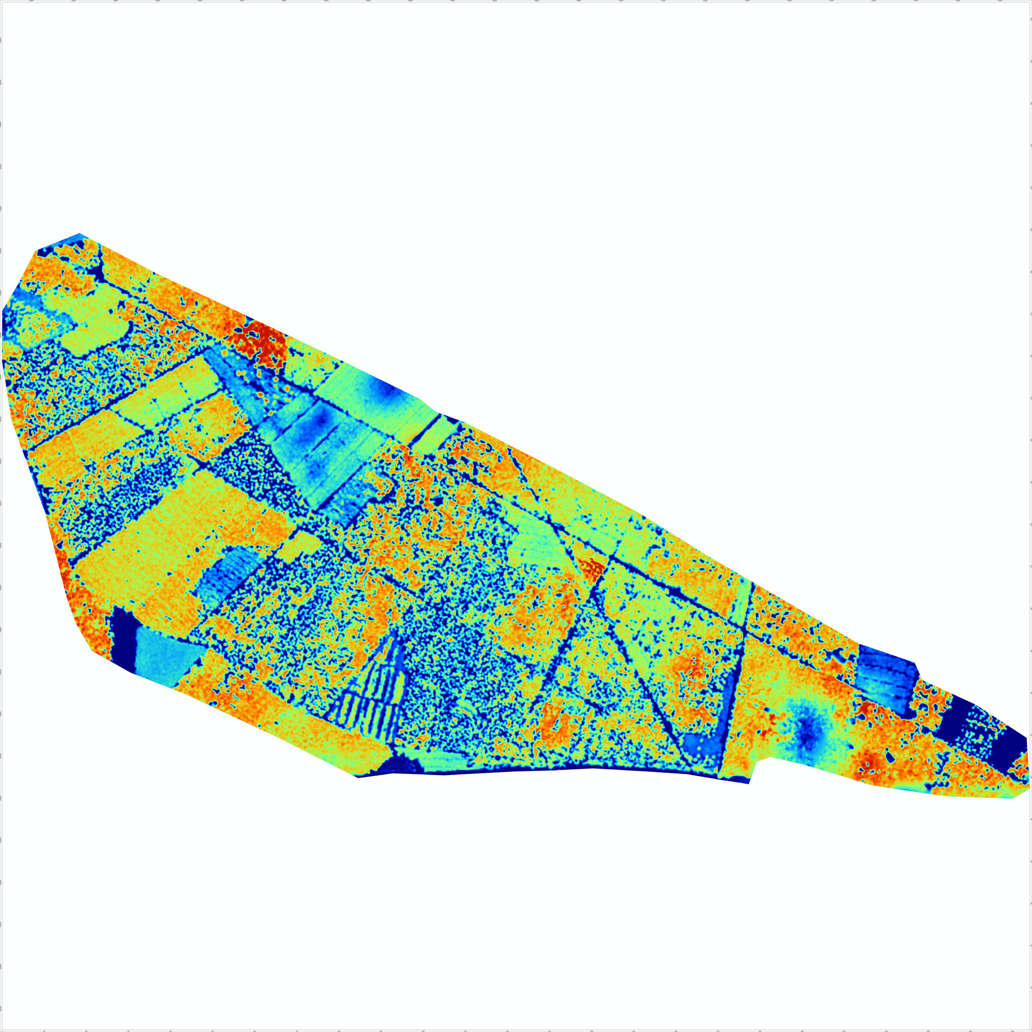
Species Composition (Satellite)
High resolution multispectral data from World View satellites were used, applying pixel unmixing analysis to derive a detailed map of the species mix between Sitka Spruce and Lodgepole Pine over a large scale forest plantation. Overlaying this result with a detailed Tree Height Model (THM) the height and yield distribution per species can be derived.


Bark Beetle Detection (Germany)
Development of a methodology to reliably detect the infection of spruce forest stands with bark beetle (Ips typographus) using multispectral imaging, plant vitality indices, 3D modelling and multivariant statistical analysis. Our joint project with Nordwestdeutsche Forstliche Versuchsanstalt (NWFVA) is now in its second year to improve the good results achieved in 2017.